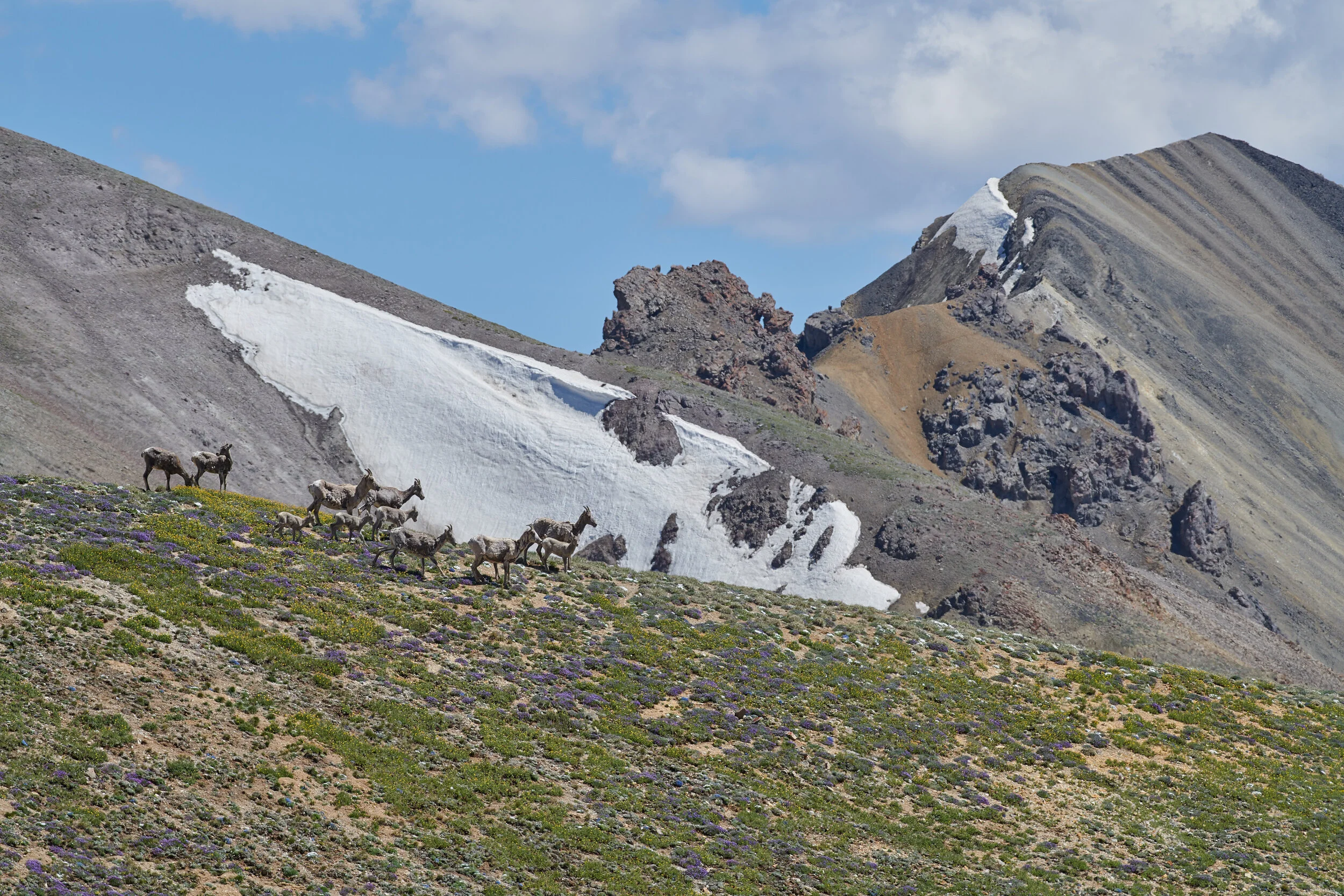


Mountain goats on a high peak in the Great Bear Wilderness


In late July, smoke from wildfires far and near pollutes the atmosphere over the Northern Rockies. Sometimes, when the sun angle is right or other clouds are above, the combination of sun and smoke give the landscape a totally new and unique appearance. Here the Teton Range is seen rising behind Venus Peak in the southeast Absaroka.


In October, the harvest full moon rises behind Heart Mountain, a cliff-rimmed mountain which stands detached from the main front of the Absaroka and Beartooth Mountain ranges.

A mule deer takes a break from the intense mid-summer heat of Wyoming’s northern deserts in the shadows of a red sandstone cliff . These rocks are part of the Chugwater formation and date from the Triassic period. Large amounts of iron minerals in the rock have oxidized which creates the formation’s characteristic red color.


Thorofare Buttes near the head of Thorofare Creek, a big wilderness waterway which flows into the Yellowstone River just upriver from Yellowstone Lake. It is thought that Thorofare Creek was named not for any features of the creek and its large watershed, but for the 25 miles of open valley which begin at its confluence with the Yellowstone River. Early travelers found easy passage thru the jackstraw timber, snowed-in passes, and rocky canyons of the Yellowstone core by following this valley to Pacific Creek. At Pacific Creek is famous Two Ocean Pass, where water covers the continental divide such that a fish could swim in either Pacific or Atlantic Ocean’s watershed. Used by Natives and then trappers and explorers, this shallow pass remains a popular route between Jackson Hole and the extensive Absaroka backcountry.


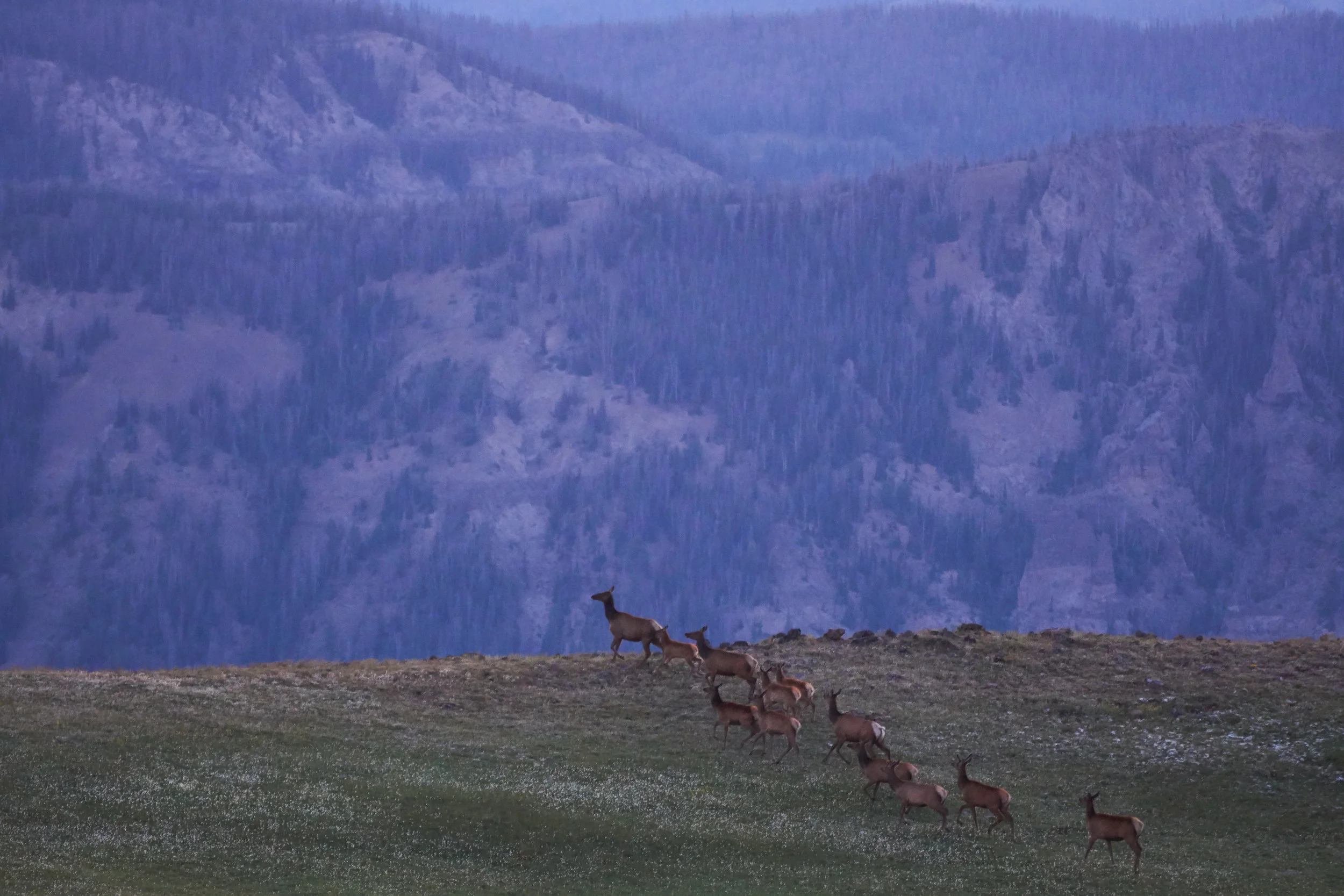
A group of 20 elk, part of a passing herd of 200, rest with their eyes closed, soaking in the early morning sun in one of the final days of fall.


Limber pine, so-called for their pliant branches, grow in savanna-like organization among cacti, sagebrush, and juniper here on this dry and windy ridge in the lee of the massive Absaroka range.

After sunset, Mt. Conness in the Yosemite backcountry shines pink in the alpenglow that occurs so often in these mountains. John Muir thought the Sierra Nevada should be called the Range of Light for “it seemed not clothed with light, but composed of it like the wall of some celestial city”.


A hunter observes through his rifle scope a group of elk belonging to a large migratory herd that summers in the remote hinterlands of Yellowstone park. As is portrayed in nearby rock art and made evident by the lithic scatter haunting their trails, humans have hunted wapiti in this region for 12,000 years.

A young wolf leaves the Lodgepole thicket that is her pack’s den to observe an intruder.

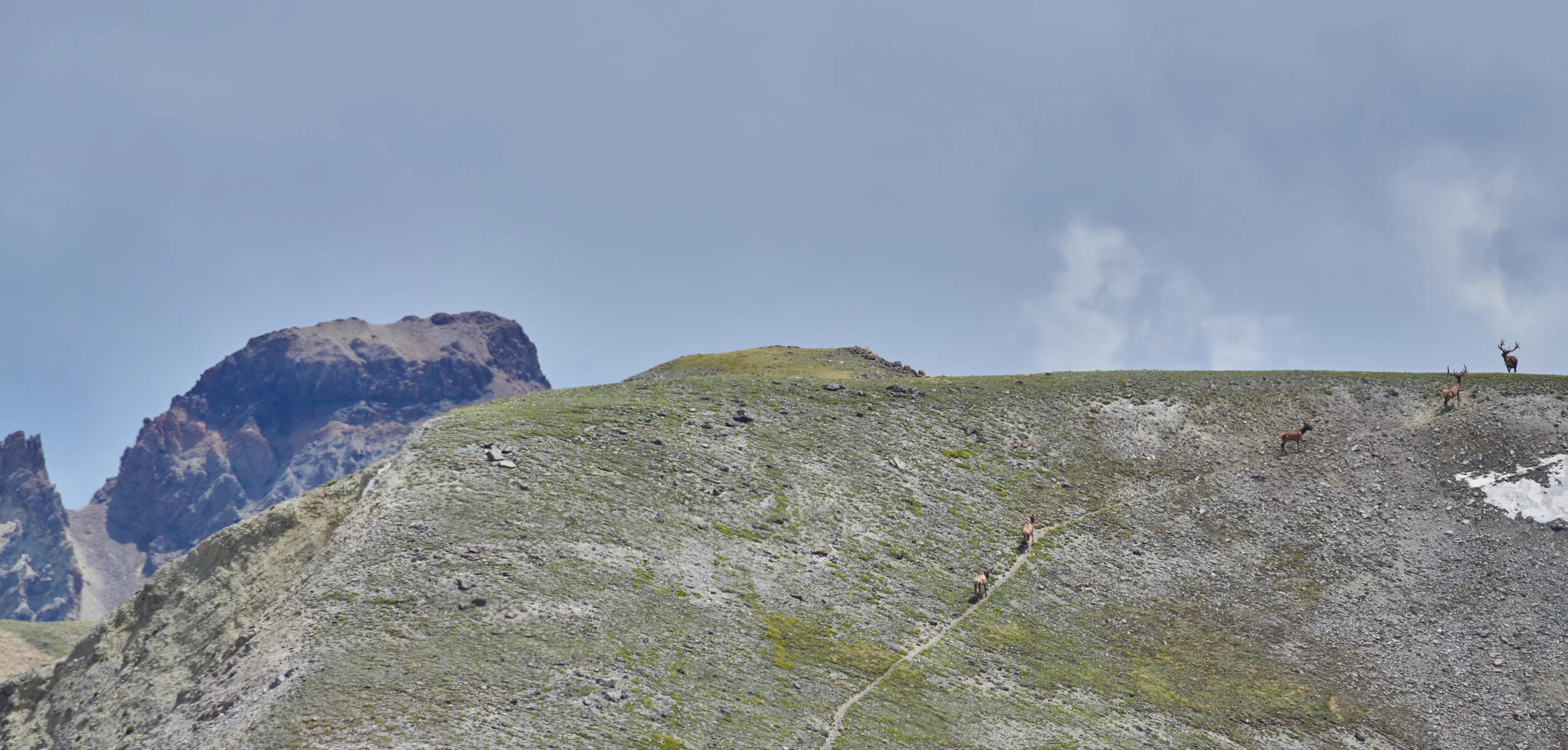
A broad, elevated, and hard-to-get-to plateau near Yellowstone’s east boundary is famous for its ungulate populations - being up there in the summer is a real wildlife safari with a sighting of the region’s prolific sheep and elk herds nearly guaranteed.

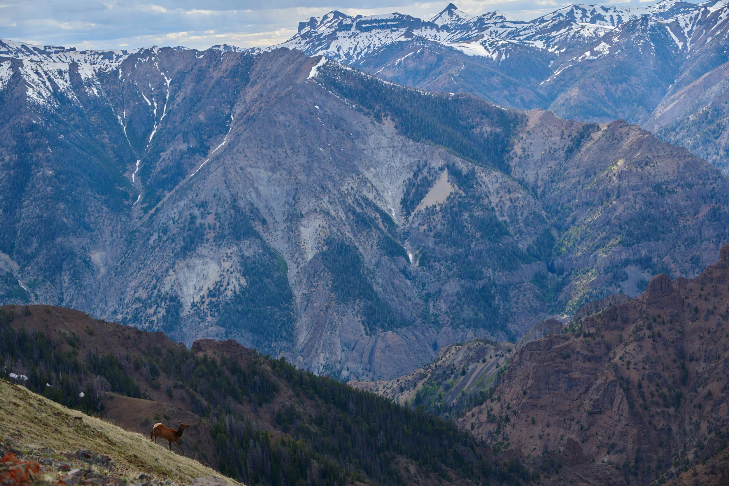
Follow this creek to the top and you are at the doorstep of region known as the most-remote in the lower 48. A vast region that is one of the biggest roadless areas in the country, the south-eastern Yellowstone wilderness complex is comprised of roughly 600,000 acres of roadless area in the SE corner of Yellowstone National Park and 1.3 million acres of designated wilderness in the Teton and Washakie Wilderness areas. Sharply eroded volcanic strata as seen here guard the broad elevated mesas and plateaus found at the top, where large elk herds and other animals proliferate.

Forget-me-nots blossom in the alpine tundra of the North Absaroka Wilderness.
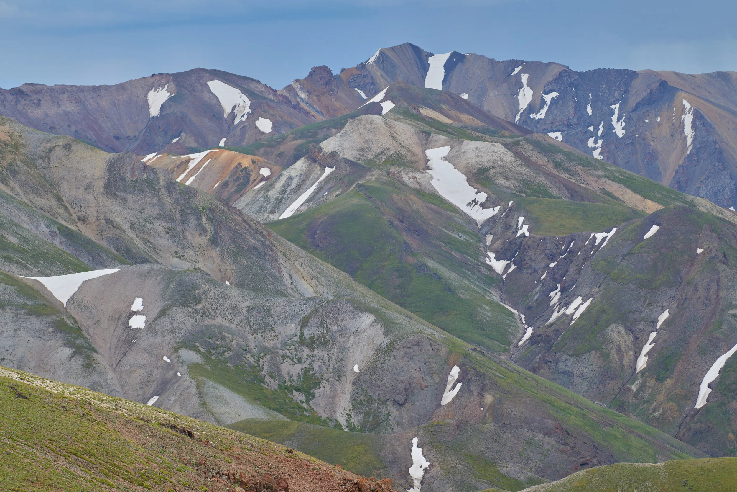
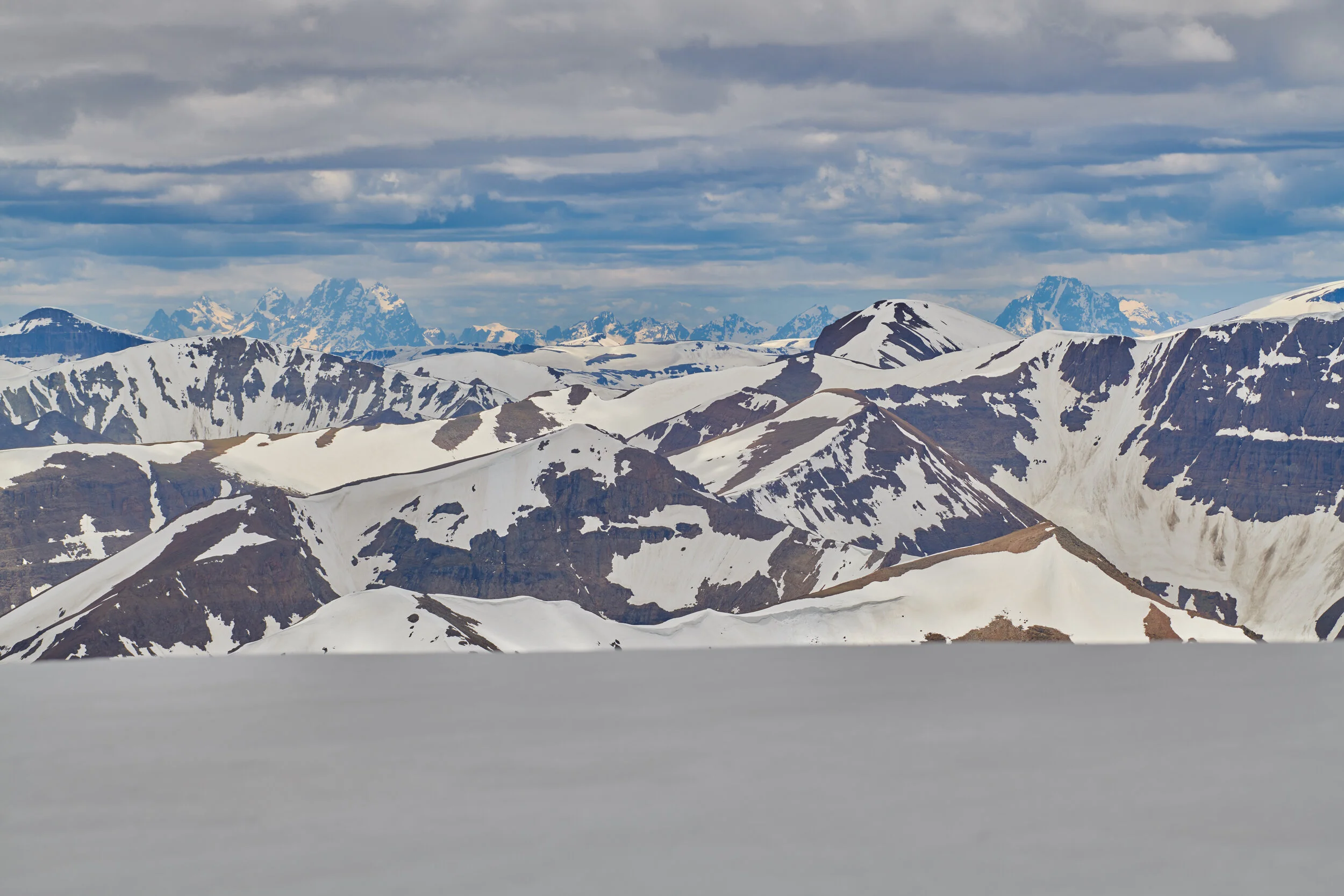
The massive Absaroka Range stretches from Livingston, Montana to the foothills of the Wind River Range near Dubois, Wyoming. This wild mountain range reaches its maximum breadth and height in its southern extent - seen here are the typical perennial snow fields, high basins, and long ridgelines broken by volcanic breccia cliffs connecting unnamed peaks that seperate the Bighorn Basin from the Yellowstone Plateau.

A herd of elk under Heart Mountain.


Seen here rising opposite the immense valley of the S. Fork Shoshone, the numerous volcanic turrets and pinnacles found on Carter Mountain’s west side are a terrifying landscape of loose rock and exposure. One of Carter Mountain’s towers is known for having stumped several famous mountaineers.

The arid and seemingly desolate landscapes that bewilder out-of-state travelers on Wyoming’s three interstate highways are actually, in many places, a wildlife paradise.

A high ridge-line in the backcountry of northern Montana known for its abundant sea-bed fossils from the Paleozoic era - a time when the rocks that make up these wilderness peaks were the bottom of a vast ocean.


A corvid, the Clark’s nutcracker, removes the seeds from the delicate cones of a Whitebark pine in Central Idaho. This tree specie differs from most regional conifers in that it has large, pea-sized wingless seeds contained in a cone that will not open up upon maturity. The seeds are a prized food for the Clark’s nutcracker who extracts the seeds from the cones and stores them in underground caches numbering in the hundreds, a reserve for later. The bird does not usually make it back to all of her caches before the winter snows, and the caches that remain are well planted and ready to germinate in the spring, a mutualism both bird and tree are dependent upon.

The winter solstice is met with a full moon in this winter of little snow in the Bighorn Basin. A small group of Pronghorn are barely visible in the lower right.

Melting snows from the previous winter obscure what little ice remains of the Stanton Glacier. Glaciers in this region of the Northern Rockies have been shrinking since the end of the last ice age, but their eventual disappearance has been hastened in recent decades.

Sunlight Peak and Stinkingwater Peak stand at the head of Sunlight Creek and the North Fork Shoshone River, which was once called the Stinkingwater River for the hot springs and sulfur vents found along its banks near Cody, Wyoming. Eventually, the name that was once reserved for only the S. Fork of this river system, the Shoshone, came to apply to both rivers.
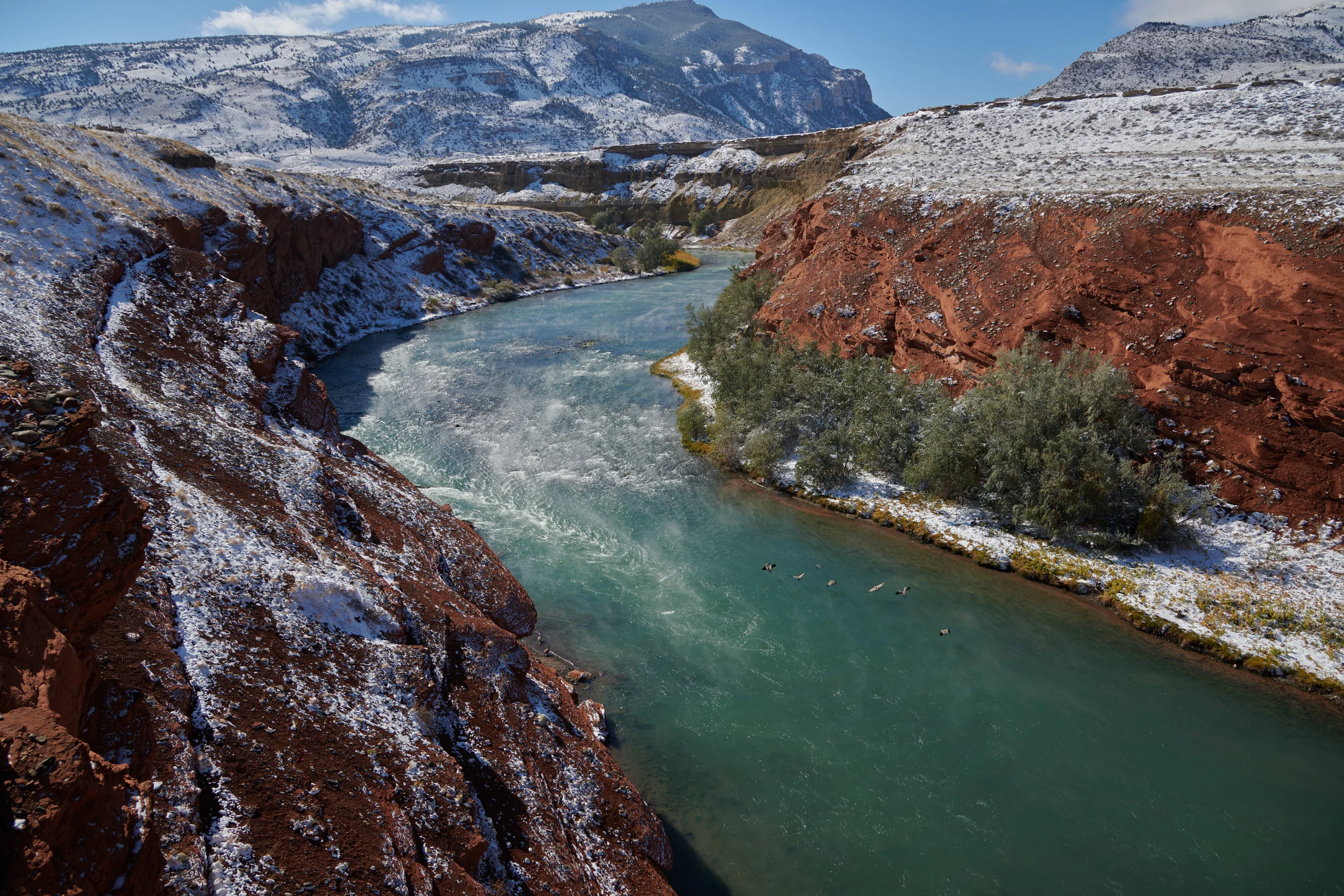
Canada geese take flight from a stretch of the Shoshone River famous for its hot springs and sulfur vents. After voluntarily leaving the Lewis and Clark expedition on their homeward journey in 1806, John Colter guided two fur trappers into the vast country he had just explored. These travels led him to the area pictured here where hot water poured from the ground and foul air spewed out of rock crevices. Like all mountain men of the era, Colter probably had few scruples about giving a story the proper embellishments. His tale of this location earned it the name ‘Colter’s hell”, a moniker that was later misapplied to the larger geyser districts of nearby Yellowstone Park.

A camera yielding astronaut in the International Space Station takes notice of the snow-clad mountains that surround the Yellowstone caldera.
Background Image © NASA, interpretive text added


other photography